Since the trolleybus system of Boston is shutting down today, we wanted to pay it homage in the form of two articles, this one containing a boatload of pictures mostly taken by me, mostly as I walked the system on February 23rd, 2022. The pictures will be provided as we walked (chronologically), and not exactly by route, with some other pictures mixed in depending on context.
If you’re reading this in 40 years (circa 2062), please note two things:
- I am very glad Tramreview got into some sort of archive and you’re able to enjoy this article/time-capsule.
- The people of Boston in 2022 were not soulless jerks for condoning the destruction of the system. This has been brewing at the MBTA for years, and seems to have been beyond our control all along.
Context
The MBTA’s Cambridge trolleybus system consists of 4 wired routes, the 71, 72, 73, and 77A, of which only the 71 and 73 see regular electric service.
The fleet of the Cambridge system consists of 28 Neoplan USA AN440LF Trolleybuses dating from 2004. They are the first low floor trolleybuses in North America, and currently the oldest operating.1 Neoplan USA went bankrupt shortly after delivering these buses, and they were not a popular manufacturer, so these are some of the last Neoplan USA buses operating anywhere, and to add, they’re bespoke, since they’re the only trolleybuses they’ve ever made, meaning getting parts for these sounds like pain.
So if you were at transit agency, you’d very much want to get rid of these by now. Let’s also say you hate wires, and want nothing to do with them, unless your predecessors forced it on you. So you’d also try to close the system outright. Fortunately for you it’s 2022 and battery buses are all the rage, what a great way to get the municipalities not to complain about increased emissions! But you need an excuse, a final straw, oh, how convenient! Road maintenance, blame it on road maintenance, since you’d want to suspend service during that time anyway.
As you can understand, this is exactly what the MBTA is doing, closing a trolleybus system out of personal desire, and making an argument for it. Their argument is compelling enough for the casual observer, and they don’t even need to mention the parts situation… Unfortunately for them there are a bunch of gaps in it…
And this is how trolleybuses die, people just don’t like non-intrusive wires. Argue that they’re a technological dead end and we shouldn’t be building them anew all you want, but there’s no reason to close an existing, functioning system, regardless of how small.
Now, enough with rambling let’s get to the actual photos before I go irrational myself and start childishly whining out of pure sentiment, like a stereotypical foamer.
Photos
When planning the itinerary with Aaron, I insisted on walking the routes outbound, to provide a better sense of directionality.
Historical Context:
Since history is also a major focus of this blog, I wanted to provide historical photos. Fortunately, an acquaintance of mine, Jim Schantz, has kindly agreed to provide a “variety pack” of historical photos from his own collection. They will be shown here at the appropriate location in a box formatted like this.
1: 77A: Harvard – North Cambridge
We arrived at Harvard in the late morning. As we exited the subway station, the smell of bacon was in the air.2 The square was quiet but bustling, the feeling was that classic urban feeling that’s been described in literature so many times I won’t bother with it here. Sometimes I like to imagine Harvard Square as the hub of an independent metropolitan area… Then the subway station would be a bit oversized for it, but you know, whatever.
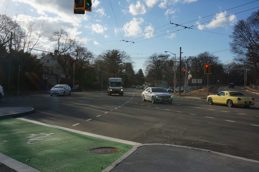
We commenced our documentation by walking north from the square along Mass Ave Massachusetts Avenue, though there are no trolleybus wires here. Remember, buses pass in a stacked busway under Harvard Square. Wires appear two blocks to the north though. Here, at the northern mouth of the busway, the 71 and 73 trolleybuses exit, make a sharp S-curve, and loop around the somewhat trapezoidally shaped Cambridge Common, laying over/stopping on Waterhouse Street (commonly called simply “Waterhouse”). The 72 would do most of the same, except for it would not lay over at Waterhouse, but the 77A would continue directly directly up Massachusetts Avenue to its destination.


From here, Massachusetts Avenue is straight as an arrow, almost until Porter Square, where it makes a slight curve.
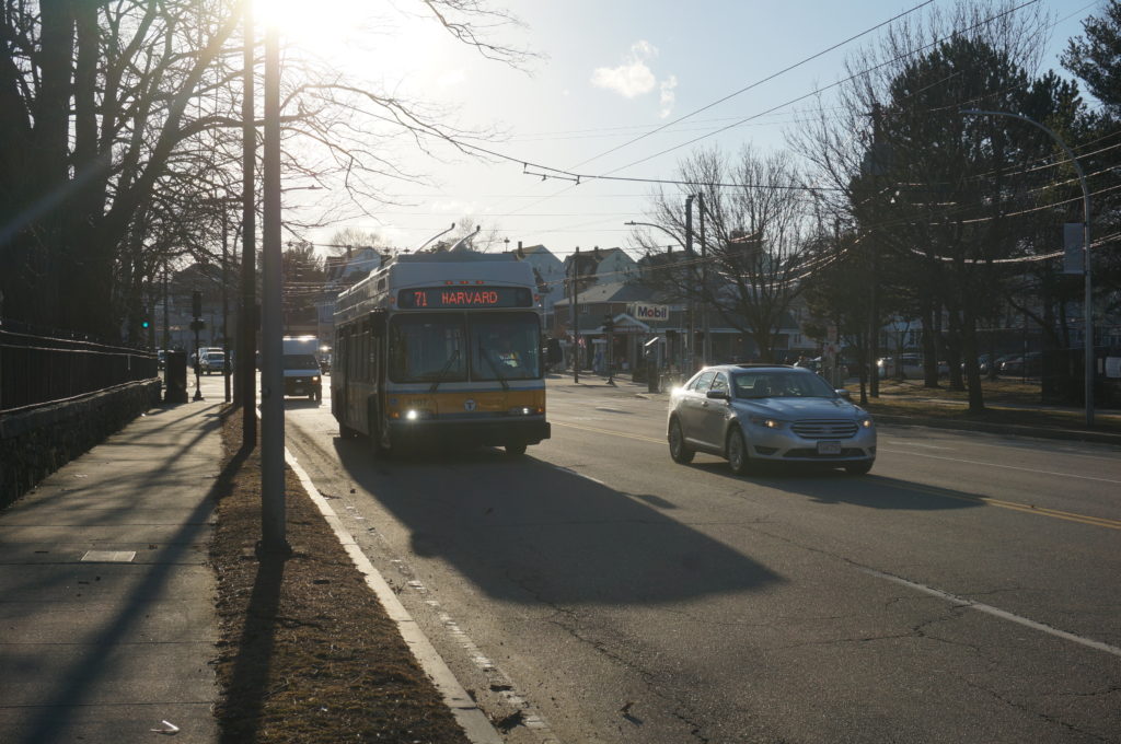
Oh, and I forgot to mention, the 77A is almost entirely a depot access route, it mostly sees trolleybuses only during the early morning and late evening (you’ll also see some peak pull-out or put-ups), otherwise the route is serviced by the 77 bus. The 77A continues only up to the North Cambridge Yard.
This distinction for depot access has existed for a long while, but didn’t really become noticeable until 1955, when the Arlington Heights route (77) was converted from streetcar to bus.3 The 77A and the associated routes only outlasted it by three years, however, before getting converted to trolleybus.
So, enjoy pictures of the Cantabrigian streetscape:


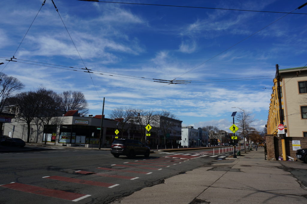
And with this, we arrive at Porter Square. As you can see the avenue has started to curve. This is where it meets with Somerville Avenue and the B&M Fitchburg Division.

One would say, that of Cambridge’s squares, Porter has the least character. This can be attributed to multiple things, firstly the relative absence of public space, as most of the square is taken up by Massachusetts and Somerville Avenues, and secondly, the Porter Square Shopping Center, with its large surface parking lot. While it’s naïve to attribute an area’s lack of distinctness to a single building, a surface parking lot taking up street frontage doesn’t particularly develop character.


The subway station meanwhile, is one of my favorite MBTA stations. While the headhouse is best described as unremarkable, and I can’t say I particularly like the wind sculpture, the station’s other elements more than make up for it. Did you know Porter is the deepest station on the MBTA, for example? The station’s deepness certainly means long escalators, but at least your ride is entertained by some art. The station cavern proper has a round top, with two platforms at offset levels. The overall design has some semblance to what’s typical of WMATA,4 leading some to nickname the Red Line north of Porter “The WMATA section of the MBTA”. Other than that, there’s also bronze gloves littered throughout the station, and the rather forgotten about commuter rail platform.
Anyway, this post isn’t about the subway station, it’s about the trolleybus wires above! Let us continue north of Porter Square to North Cambridge.


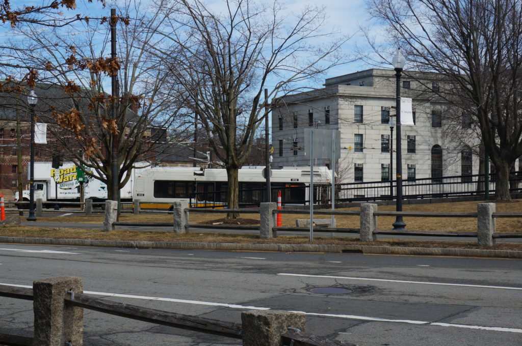
North Cambridge Yard/Carhouse
And at this, we arrive at the North Cambridge Yard (sometimes called the North Cambridge Carhouse). While this would not fit the typical description for “the Heart of the System”, it is what makes it function, being the yard of the Harvard-based trolleybus system.5 The yard contains a shed for the trolleybuses and a wired parking lot. Since the MBTA is good at underutilising their trolleybuses, you would often see them parked in the yard. Sometimes there may be diesel buses in there, but it’s rarer. The carhouse sits on the site of many older streetcar carhouses.
Of course, here are some pictures, we didn’t have many good one from that day, so these are kinda shuffled:

The back of the yard is conveniently adjacent to the Somerville Community Path, allowing one to get pictures from the back:


Complementing historical photos from Jim:6
2009:

We’re not aware of an E800 fantrip going on at this time. The bus (4037) was sold to the Shoreline Trolley Museum around this time.7
1976:


We took a DIESEL 77 back, happy to have been done with about a quarter of our walking. We had not seen a single moving trolleybus on 77 wires during this time.
2: 72: Harvard – Aberdeen
We missed the appropriate stop on the 77, and so deboarded in a totally, very much, completely, 100% ADA accessible manner on the lower busway8 We exited the station at the exact same exit we had earlier. The smell of bacon was no longer in the air, it was now midday, but we nonetheless had a déjà vu walking in the exact same way through the busier square. At the southern end of the Cambridge Common we diverged from our previous route and headed towards our next target, the 72.
So, of the routes, the 72 is a bit of an outlier. It is a short local route heading north from Harvard Square and passing through relatively local streets, before ending at a gorgeous U-turn loop at the intersection of Aberdeen Avenue and Mount Auburn Street.
As said, the 72 does loop around Cambridge Common like the other routes, but instead of turning onto Waterhouse, it continues north for a short section of Garden Street and later Concord Avenue.
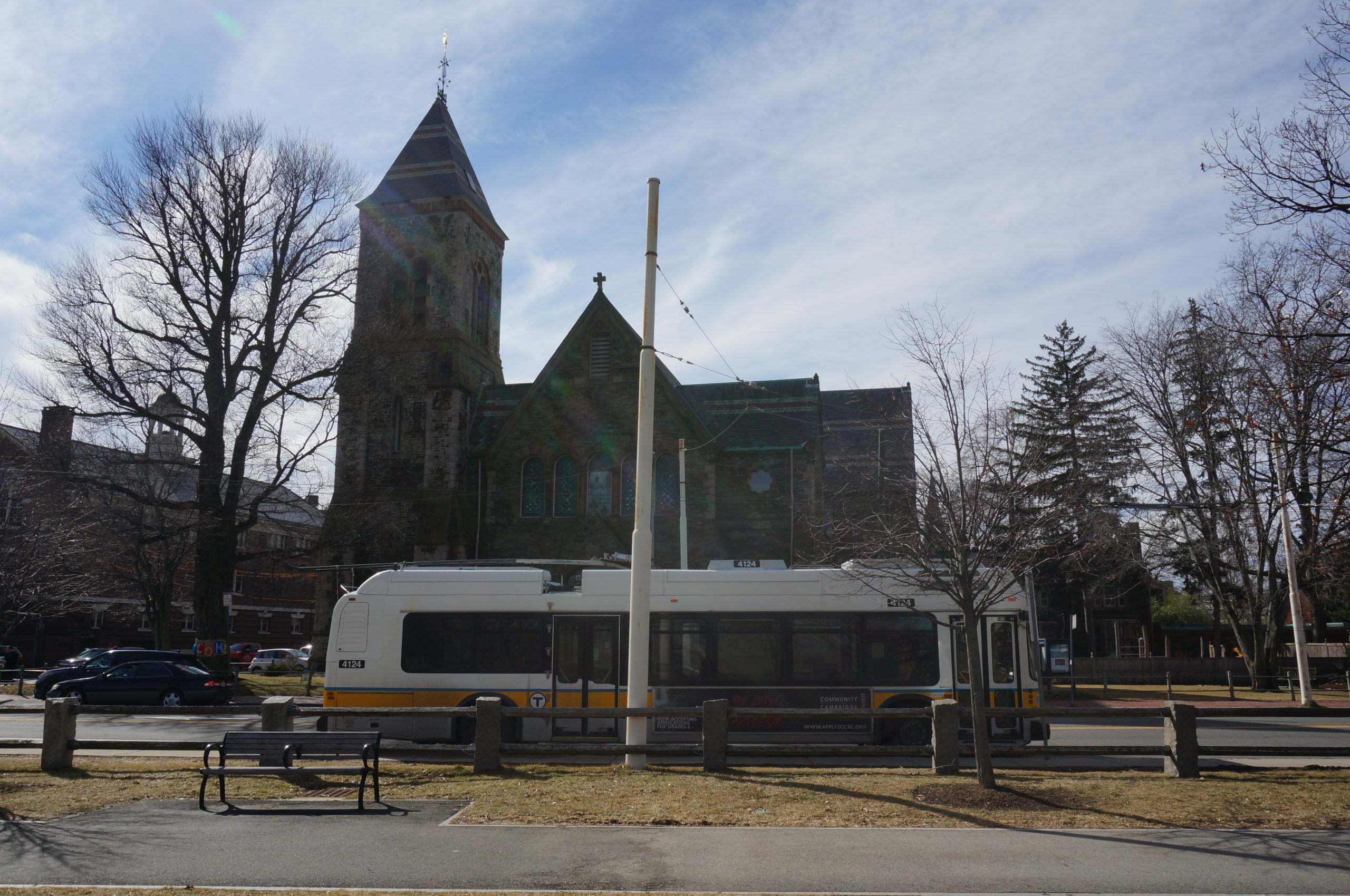
Anyway, the first remarkable thing on our walk was this, trolleybus 4124 solemnly parked near Garden Street at Mason Street, poles down.

We don’t know what it was doing there, but while we walked by it, a trolleybus passed.


I believe the driver waved at us but I’m not sure. Aaron remarked on how the drivers are likely seeing a lot of photographers in this last month of operation.


Anyway, from here we headed up Garden Street for one block and then turned onto Concord Avenue at Arsenal Square.

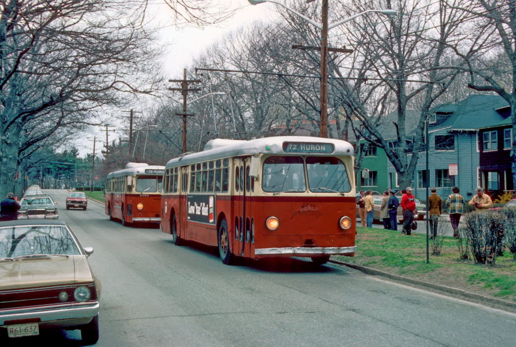
I think this is a good opportunity to explain the 72. The 72 is the oldest intact trolleybus route in Boston, being converted from streetcar in the late 30’s (the rest of this system was converted in 1958 while the Silver Line is a 21st century creation). It is commonly known as the Huron Avenue line, due to its significant section on Huron Avenue. It hasn’t ran revenue trolleybuses since 2013, due to road construction at the time, and at the end of construction, electric service never resumed. The 72 has slowly been losing service and significance since, having the 75 realigned to share basically all of its route in 2019, then fading into 71/75 short turns not long after. Today it’s a bit of a ghost route on the MBTA, with the sign never really used, instead buses are usually signed as either 71s or 75s depending on the section they’re on. It is marked on stops, but schedules are a bit spotty with showing the number.
Back to Concord Avenue:


As you can see, this section of Concord Avenue is decently dense and residential, and was also as such in 1976. The plot behind a fence seen in the northern section is the Harvard Observatory, as you can see they observe trolleybuses.
After this stretch, the 72 makes a turn onto Huron Avenue. The intersection is commercial, but then fades into residential, with only to some storefronts near the section with Standish Street and Fresh Pond.

This is typical of the scenery you’d see along Huron Avenue. (own image) 
Huron @ Sparks. (own image) 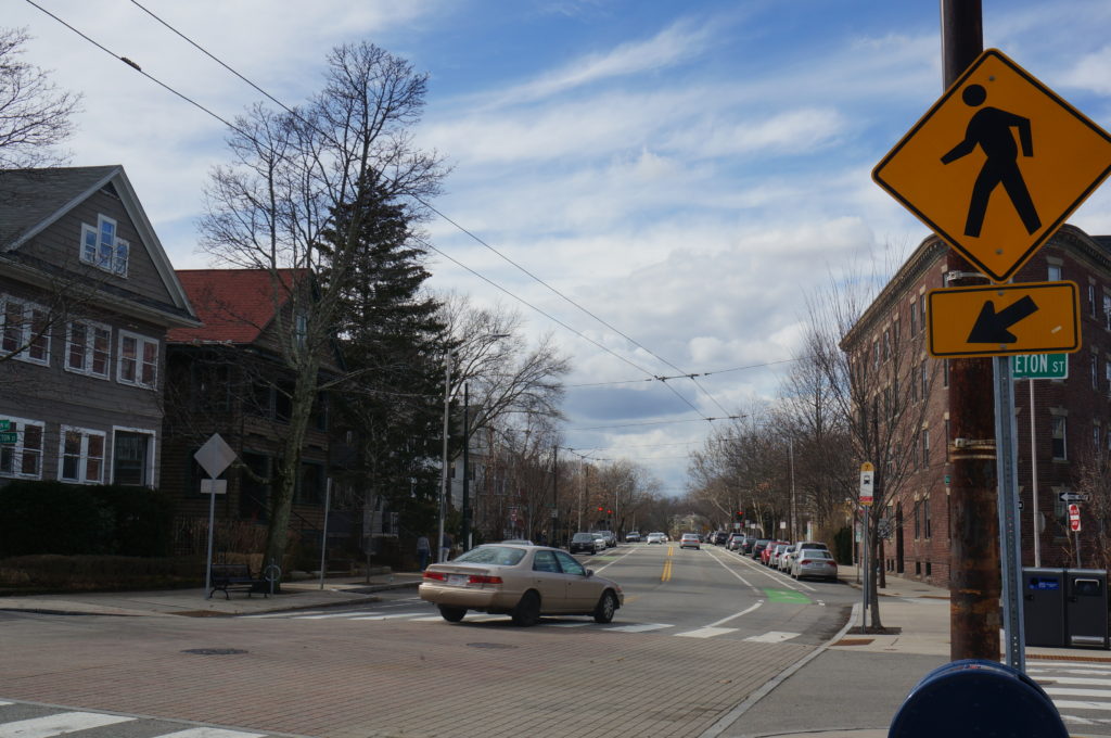
Huron @ Appleton. (own image) 
A sign for the 72 and 75, Huron @ Vassal. (own image) 
Huron @ Ganville, also known as “Elva (Physic) Harrell Square”, according to the City of Cambridge, at least. (own image) 
Huron @ Fayerweather. (own image) 
Huron @ Clinton, note the clock, probably related to the Cambridgre Trust just next to it. Personally I find these clocks interesting, they’re kind of an unremarkable landmark. By the way, this intersection is also known as “Connor’s “corner” Square”. (own image) 
Huron @ Lakeview. (own image) 
Huron @ Larch. (own image) 
DIESEL under wire! Simply unacceptable and quintessential MBTA. (own image)
If you want to joke about me taking a picture pretty much every block (there were a few more I didn’t put in the slideshow), you have every right to do so. Hey, it was a nice street on a nice day, if only they ran trolleybuses here…
Anyway, at this we reach the 72’s least significant but most well known section, the ~3 blocks travelled on Aberdeen Avenue!
Why is this the 72’s most well known section, you may ask, well you see, two things:
- It is the 72’s only unique section.
- It has a median, and on the one (1) stop on it, the 72 traditionally used left hand boarding.9

As said, this section is well known and loved by foamers, so as you can understand it’s important for us to document it quite well.


And now, behold again, the one and only left hand surface stop on the MBTA and its lone bench!


And now, behold again again, a trolleybus U-turn! Don’t we all love trolleybus U-turns? Ah, ok, seemingly not, whatever.


This isn’t from Jim, but he did confirm it happened. I spotted it while looking through Wikimedia:

Apparently, in 1971, the MBTA loaned a Flyer E700 trolleybus from the TTC in Toronto to trial. As you know, the MBTA ended up ordering E800s from Flyer a few years later. With the tight North American trolleybus market, vehicle loans and trials from other systems are/were quite common. It’s a good way to see what modern trolleybuses look like, though sometimes the trial may fail…10
And with this we end our view of the 72. Overall it’s quite a cool route, and it’s a shame the wires were not put to good use recently. In an ideal world one would trolleybus the 75 in order to make them actually practical,11 but we don’t live in an ideal world, do we?
3: 73: [Junction]* – Waverley
Now, let us cover an actually important route that saw regular trolleybus service until the very end, the 73. *In order to make our walking more efficient, we decided to walk the 73 from Aberdeen and up, and then walk the 71 wholly, so enjoy this section, with the Mount Auburn section pictures being as part of the 71 section.
As said, we started at Aberdeen, which has a Star Market nearby. From this Star Market, we’ll be walking to the next Star Market, conveniently located at Waverley.


Oh look!

This stretch of Belmont Street (yes, it’s Belmont Street even in Belmont), is lined with Bostonian Three Deckers mixed with commercial. We will stay on Belmont Street until Benton Square.


The street also fairly curvy and climbs up a hill here. The scenery hasn’t changed much since the 50s, and 60s, and even then, it supposedly wasn’t that different to the 1910’s, since:

On Sunday, February 24th, 1963, an old Bostonian two-trucker, number 396, ran up the street. This was for filming a scene in a movie called The Cardinal, with the streetcar scene set in the 1910s. 396 had survived as a testing car with the Boston Elevated, and was later preserved by Seashore. For the movie, the car was sent to Boston where it was restored and fitted with a trolleybus style pole. The tracks on the street survived from the conversion of the streetcars to trolleybus in 1958, with the town of Belmont not to be bothered with removing them.
The car ran up the street for the movie, and then Seashore members ran it down the street in traffic. As you can understand, a large amount of residents and railfans were present at the scene.


Jim, a high school student at the time, was present at the scene. He describes it as a fun and memorable event. He missed the trip down the street, quite unfortunate, however this means he was the only one who got pictures of the car running in traffic.

396 can be found today on public display at the Seashore Trolley Museum in Kennebunkport, Maine. The car is typically found in the Highwood Barn at the museum. In addition to this movie, the car participated in the filming of a television show at some point in the 70s.
From here, it’s only a short while until we leave Belmont Street at Benton Square.


And now we encounter this horrendous sign. Not only is there an excessive possessive comma (“reduce speed” does not belong to “trackless trolley”), but in the bus icon, there is a pantograph bus, a pantograph bus. I don’t know who made this, but like, 5 minutes of care would’ve made this sign actually look decent.12
Also, fun fact, “trackless trolley’s” don’t actually reduce speed to “5 M. P. H.” here.
Ok, at this we arrive at Benton Square, which happens to also be where the hill plateaus. Benton Square used to have a turning loop for the 73, but when the wires were renewed in 2016, they were not returned to the loop. The loop is otherwise unremarkable but there are a lot of pictures of it.


The Benton Square loop was also a fantrip favorite.
2009:


1976:


Considering the different positions of the buses, and those not matching with wireage, it is hard to be certain about their maneuvering during that fantrip.13
Interestingly enough, the angle of Belmont Street looking southwards from Benton Square happens to match with the heart of the Boston skyline, and visibility was good enough that day. Once we realised this, we waited at the corner for a 73 to come.

I caught the moment! Neoplan 4111 gracefully heading up the hill with the Boston skyline in the background.14


We continued past Benton, onto Trapelo Road.15 The scenery stays very similar, but we start heading slightly downwards.


411116 Flexing that electric motor torque heading up the hill at Trapelo @ Bernard.


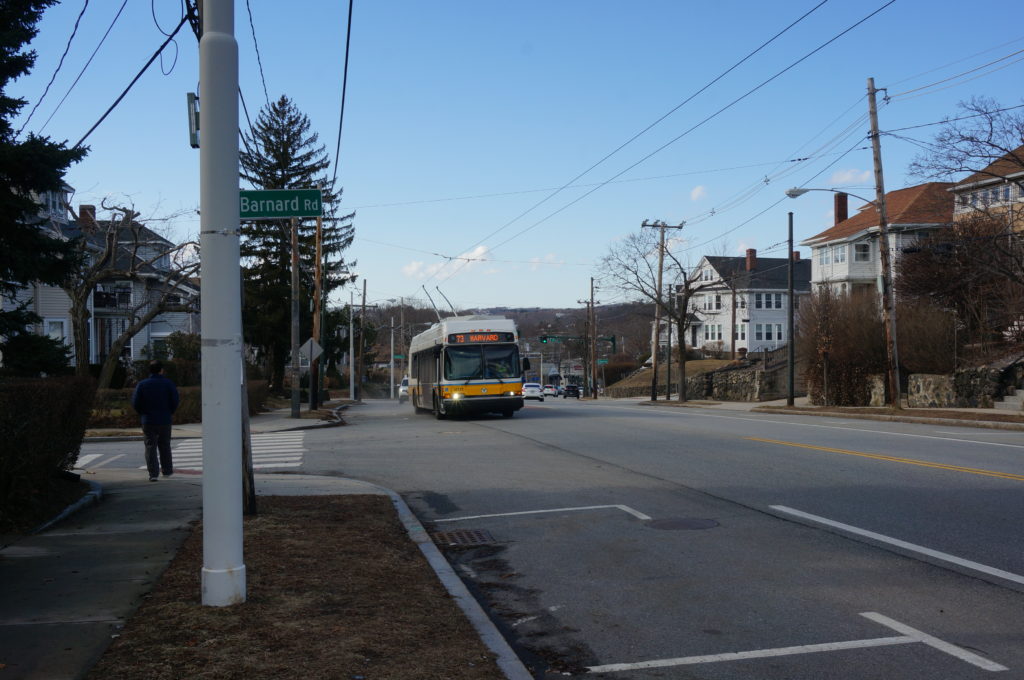
Waverley, crudely, is where Trapelo Road intersects the B&M Fitchburg Division, and Lexington Street. It’s a commercial center and a busy auto junction. The 73 makes a clockwise turn around the commuter rail station here, via Church Street, Lexington Street, and back to Trapelo. It stops twice as part of this loop, and the layover is located at the first stop.


Here are some pictures from earlier in February to give you a better idea of what Waverley looks like.


We took a 73 back, tired but satisfied.
4: Busway & Bennett
Busway – Northern Portal
We decided to disembark from the 73 at Waterhouse instead of at the busway, firstly because neither of us has done it before, and secondly so we could get good pictures of Waterhouse and the busway portals.

We walked through the square on the surface, but not before taking pictures of the northern portal proper.


I’m surprised the spot above the busway is not a well known foamer spot, as it provides for good, well balanced pictures with lots of activity, and there are no signs telling you not to be there.

As you can see, the volume of buses here is surely more than enough to justify a busway, and fortunately for us, the Boston Elevated in its wisdom, had made the decision for us more than 100 years ago, when it was all streetcars. Weirdly enough, the busway was never extended since its construction. I guess there were never the traffic volumes to justify that around Harvard.
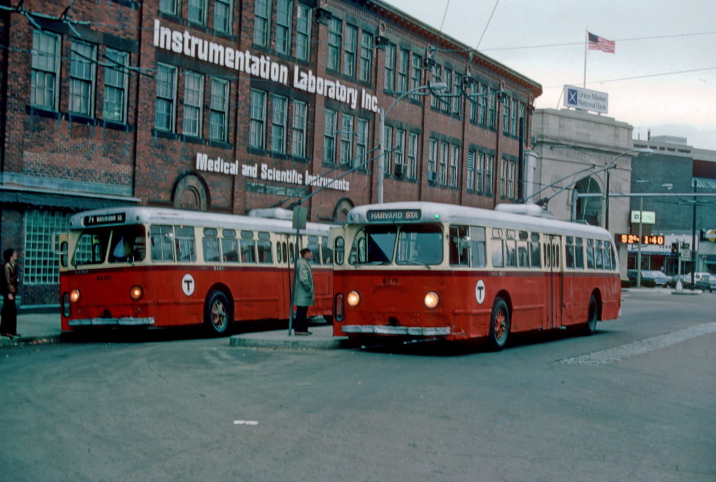
Jim also has images of the northern portal, albeit from a far more interesting angle:


Imagine if today you could just casually have photo stops on busy transit corridors on fantrips! 8515 also seems to be a regular revenue trip they stopped, so that adds to the remarkability of these shots.
If the busway portal doesn’t correspond to what it looks like today (it doesn’t), this is since it was rebuilt in 1978.
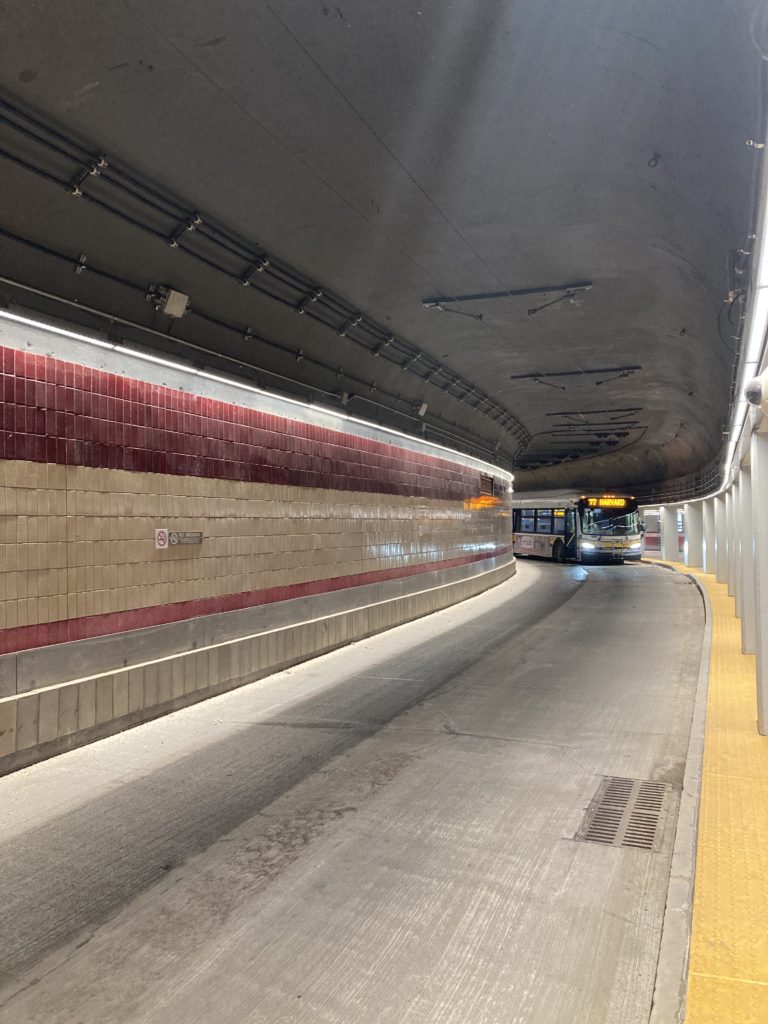
Busway
Inside, the busway is composed of two levels, both of which curve to form some sort of a Λ shape with the similarly stacked Red Line platforms, resulting in an easily navigable, and spacious station.

But here’s the catch, both bus platforms are on the inward side, which means that one of them is going to be left-hand, specifically the southbound one. In this case it’s the lower busway. Historically this has never been a problem, as streetcars in Boston, with the major exception of the PCC, were always double ended, meaning they had left hand doors,17 and even when trolleybuses were introduced to the busway, Boston had so many left hand surface stops left over from streetcars, that most of them had left-hand doors. Of course, over time basically all left-hand surface stops disappeared, leaving the unconvertable lower busway alone. Then the MTA/MBTA started to acquire buses with no left hand doors… leaving the trolleybus fleet alone with left hand doors (if you never noticed in all the images). The left hand door had been a major sticking point for the MBTA, since it means more expensive trolleybuses, and with a smaller fleet, this is hard to justify.
Of course, the lower busway is still used, except for the 71/73 are the only ones to board there, from a special raised platform,18 the rest of the buses simply unload there, with passengers disembarking facing the wall. Of course, this is not wheelchair accessible in any way, and with the closure of the trolleybuses, the lower busway would become inaccessible for all buses. This is still an unsolved problem,19 and highlights the MBTA’s determination to murder its trolleybuses.
Bennett
Another thing to note on the southern end of the busway is Bennett Alley, this alley is used by most buses arriving to Harvard from the south or those that terminate there from the north. It is MBTA owned, and it and the building next to it are the last remnants of a once-massive subway, streetcar, and trolleybus yard that existed at Harvard.


There is a wired loop at the southern end of the busway, passing via the alley, it was historically used by the 72 to turn around, and today is used for random service trips.

Here’s Bennett Alley proper, the building to the right is the Conductor’s Building, it was historically used as a transit office, but today houses a restaurant (which I assume has a good view of… buses). The alley also typically has a reserve bus stationed.


The trolleybus yard still existed at the site in 1976, as such, Jim has provided pictures of it too:


There is also a picture of the alley in 2009:

5: 71: Harvard – Watertown
As you can understand, being at Bennett Alley very conveniently puts us at the start of the 71/73 trunk down Mount Auburn Street. So here we are, finishing our massive walk.


Mount Auburn Street is quite a straight street until past the junction, only then does it begin to curve and be a bit hilly on its approach to Watertown.


The street is line with all kinds of things, residential, commercial, office, and here, a hospital. The density varies too, it’s like this all the way to Watertown.


We now cross Fresh Pond Parkway with a bit of an awkward junction, but fortunately the city made sure it’s actually traversable in some form by pedestrians and cyclists.


And at this we reach Aberdeen, yeah, Mount Auburn Street is quite unremarkable.


From this point on the afternoon sun and my stubbornness regarding taking pictures outbound start destroying the photos.


Here we part with the 73, and continue with the 71.


Our friend from Benton, 4111, taking that curve. (own image) 
Blurry 4115 heading outbound. (own image) 
4101 taking a different curve, Mount Auburn Street is pretty curvy.. (own image) 
A random bench… and the street. (own image) 
New Jersey Route 16 sign… No idea what it’s doing here other than this is Massachusetts Route 16. (own image)
If you noticed, the condition of the street here is far from ideal, and the repair of this street is the excuse by the MBTA to close the system now.


4115 heading out of Watertown. (own image) 
This is how you know you’re in Boston. (own image) 
The sun with Watertown Square in the foreground. (own image) 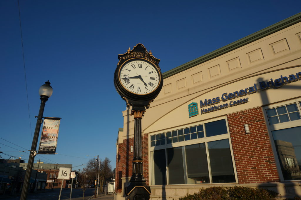
The unremarkable landmark known as a street clock. (own image) 
Crossing the Charles. 
Watertown Yard, note the wires that are just there, not actually servicing anything. 
Back across the Charles. (own image) 
Watertown Square. (own image)
And with this, to (obviously) no applause, we finished our walk of every trolleybus route, to document for posterity and people abroad who may never have experienced the system, and, if the MBTA gets its way, never will.
This took us about 5 hours.
Watertown Loop
Here’s a picture from the loop at Watertown, note that this is an clockwise loop with two electrified platforms. It is also used by the 59 bus. Most buses in Watertown actually stop on the other side of the river at Watertown Yard.


Do note that the direction of the loop was counter-clockwise in 1976, I do not know why that is in the first place or why it has flipped since. Good that Watertown has less asphalt nowadays.
Conclusion
The optimist inside me wishes that it won’t be long after the MBTA makes this shutdown that the public, municipalities, and press catch up to them, with no significant damage being done, or that at least Boston invests in IMC as recommended by TransitMatters within the next decade or two.
The pessimist inside me sees how all the wires are removed within the month, the promised battery buses get indefinitely delayed or severely underperform, and all this significantly sours the MBTA’s relationship with Cambridge, Belmont, and Watertown, preventing other, actually beneficial projects from getting done.
The realist inside me predicts that, while this we let a reliable piece of infrastructure, transportation, and transit history and culture go to waste, we can use this use this as a moment to recognize that while we’ve done great progress at getting the MBTA to stop moving backwards, there’s a lot of work to be done to make it actually go forwards. We must recognize the mistakes of the past, and prevent them in the future.
We hope you have enjoyed this post, if you have any questions, comments, feedback? please do not hesitate to comment or contact us.
One reply on “Boston Trolleybuses: Part 1 – Photographic Documentation”
Clarified with Bradley:
– The 1976 fantrip was a BSRA fantrip.
– The picture with him between two buses is indeed a photo stop.
– The 2009 fantrip was also a BSRA trip.